
Access to the old miner’s track
This 3-5 day advanced tramping route crosses Kahurangi National Park from the road end to Anatoki Forks Hut, onward to Waingaro Forks Hut, then out to the road end. The start is reached by turning off SH 60 onto Kotinga Road, 1 km south of Tākaka Township, then following the road nearly to its end and taking the signed road for 3 km to a small car park and intentions shelter. DOC
From the car park, markers lead across Go Ahead Creek and up to an old benched gold miner’s track. The first leg to Anatoki Forks Hut is 17 km and listed as 8 hr. Deep, steep, rocky side creeks are unbridged; they can be difficult in normal conditions and dangerous in flood. The track passes regenerating forest, then mixed beech and podocarp forest, before zigzagging down to Anatoki Bend, where camping is possible. DOC
Forks, water races and the lake
Anatoki Forks Hut has 6 bunks and stands amid evidence of old gold workings. Its tap water is untreated and must be boiled; the hut also has running water and a wetback that can provide a hot shower. For Waingaro Forks Hut, take the left branch at the junction near the hut. The right branch crosses the Anatoki River and climbs toward Adelaide Tarn Hut. DOC
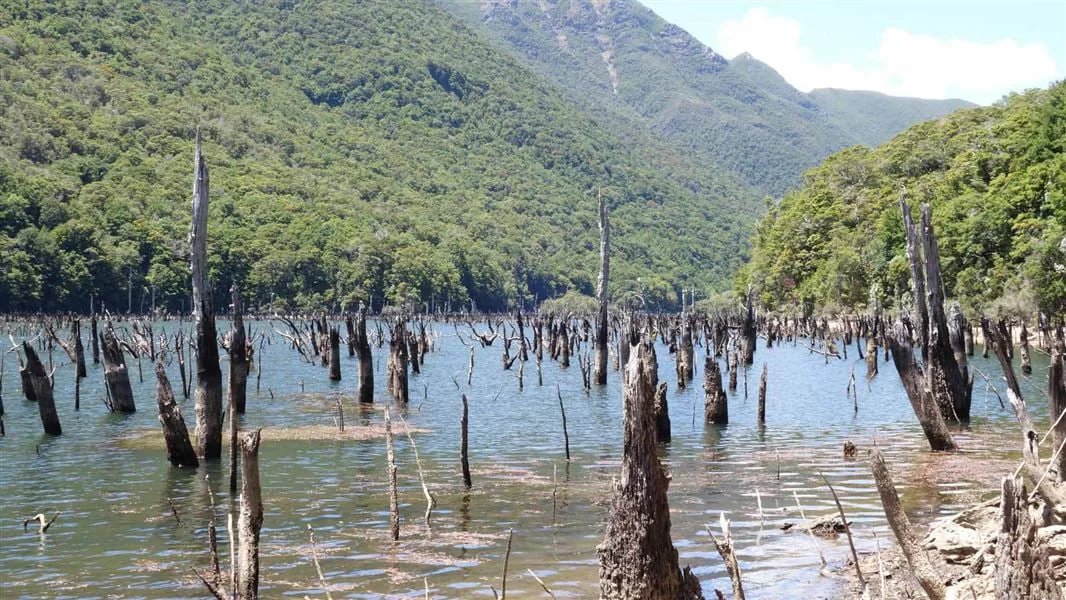
The Waingaro-bound route first follows remains of water races, then climbs to a saddle, crossing and recrossing a stream before descending to the Stanley River. A clearing there suits camping. Just less than one hour farther is the western end of Lake Stanley, formed in the Murchison earthquake in 1929; Soper Shelter stands nearby. At the lake’s eastern end, a large slip remains unstable, and DOC says it is not safe to camp there. DOC
Waingaro Forks to the Lockett Range
From the eastern end of Lake Stanley, the route continues for 3 hours – 3 hours 30 minutes to historic Waingaro Forks Hut, crossing forest and gravel flats and climbing to avoid the gorge near the Waingaro and Stanley Rivers junction. The onward leg to the road end is 18 km and listed as 6–7 hr. A 200 metre walk upstream from the hut reaches a swingbridge across the rocky Waingaro River gorge. DOC
The old pack track climbs the Lockett Range through beech forest. At Skeet Creek, reached two hours from the hut, walkers can replenish water. Beyond it the vegetation opens into stunted shrubland, with views along the range. Riordans Hut is a signed detour; continuing on the main route, the restored Tin Hut lies in bush 60 metres below the track, its roof visible from above. DOC
A historic route governed by water
The track descends Kill Devil Ridge in zigzags through regenerating bush, predominantly gorse and bracken, to Uruwhenua Road. A further 3 kilometres leads back to the State Highway near Lindsay’s Bridge. This was a gold miners’ packhorse track built in the 1890s; three restored character huts from 1930s mining days preserve a rare combination of old route and historic shelter. DOC
Remote terrain, rough ground and freezing conditions can occur at any time of year. Rain can flood unbridged rivers and alter plans, so carry a distress beacon, emergency shelter and topographic map, and be prepared to wait or turn back at unsafe crossings. DOC classifies the route for experienced, fit, well-equipped trampers. Wasps are particularly common from December until April; dogs are not allowed. DOC
Sources & further reading
Sources, dates, or details to query? Read our editorial approach.


