
The river is the first decision
Brewster Track begins at Fantail Falls beside State Highway 6. Before the climb, the route crosses the unbridged Haast River, making river conditions part of the outing’s central choice. Rain or snowmelt can raise the water, and the crossing may be unsafe or impossible on the return. If the current is faster than walking pace, the water is discoloured, or debris is moving in it, do not cross. DOC
DOC strongly recommends not hiking Brewster Track if rain is forecast: the river can rise during the hike and cut off the car park. Carry an emergency shelter and spare food in case a wait becomes necessary. The crossing sets the tone for this route: progress depends on conditions, not just fitness or pace. DOC
Beech forest to open ridge
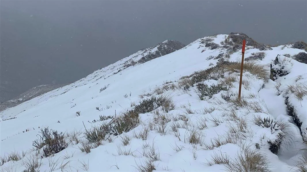
After the river, the track climbs steadily through beech forest to the bush line. The ground is rough, steep and slippery, and the route is described as very steep and unformed; sturdy footwear with good grip and strong balance matter here. At the bush line, forest gives way to a snow grass face, then a narrow ridge leading toward the hut. DOC
Brewster Hut is the track’s end. Its alpine setting marks a clear boundary: there is no formed track onward to Mt Armstrong or Brewster Glacier. Beyond the hut lies challenging untracked terrain with steep drops, poor visibility risks and unstable glacier ice. The hut’s presence should not be mistaken for a maintained route farther into the mountains. DOC
Weather changes the outing
Freezing, wet weather can occur even in summer, and conditions change quickly. Warm, waterproof and windproof clothing, a distress beacon, emergency shelter and spare food are essential even for a day trip. Low cloud and whiteout conditions can disorient hikers year-round; if cloud or rain develops, the safer choice is to turn back or stay at the hut rather than continue into untracked ground. DOC
From May to November, snow, ice, avalanches and sub-zero temperatures raise the technical demands. The track is then suitable only for people with mountaineering skills, experience and equipment, including the ability to navigate when marker poles disappear and to manage avalanche terrain. This is a route whose season changes its character, not merely its clothing list. DOC
Plan around the return
The listed distance is 5 km return via the same track, with a 6–8 hour return time. That compact distance understates the challenge: the steep climb, slippery ground and unbridged river make it an advanced tramp. If the river is high, the weather poor, or the required fitness and gear are absent, the evidence packet points to the Blue Pools Track as a shorter alternative; the river crossing and weather remain the key go/no-go decisions for Brewster. DOC
Sources & further reading
Sources, dates, or details to query? Read our editorial approach.


