
Start from the Matukituki side
Cascade Saddle links the West Matukituki Valley with the Dart Valley. The recommended approach starts at Raspberry Creek car park and climbs toward the saddle; going down the steep Matukituki side in reverse is much harder. The crossing is for experienced trampers with strong navigation and backcountry skills, and DOC recommends attempting it in fine weather in mid to late summer. DOC
From Wanaka, the drive to Raspberry Creek car park is 54 km, with the last 30 km unsealed. The West Matukituki Track leads to Aspiring Hut, a serviced alpine hut with untreated tap water that must be boiled. DOC
Forest to exposed ridge
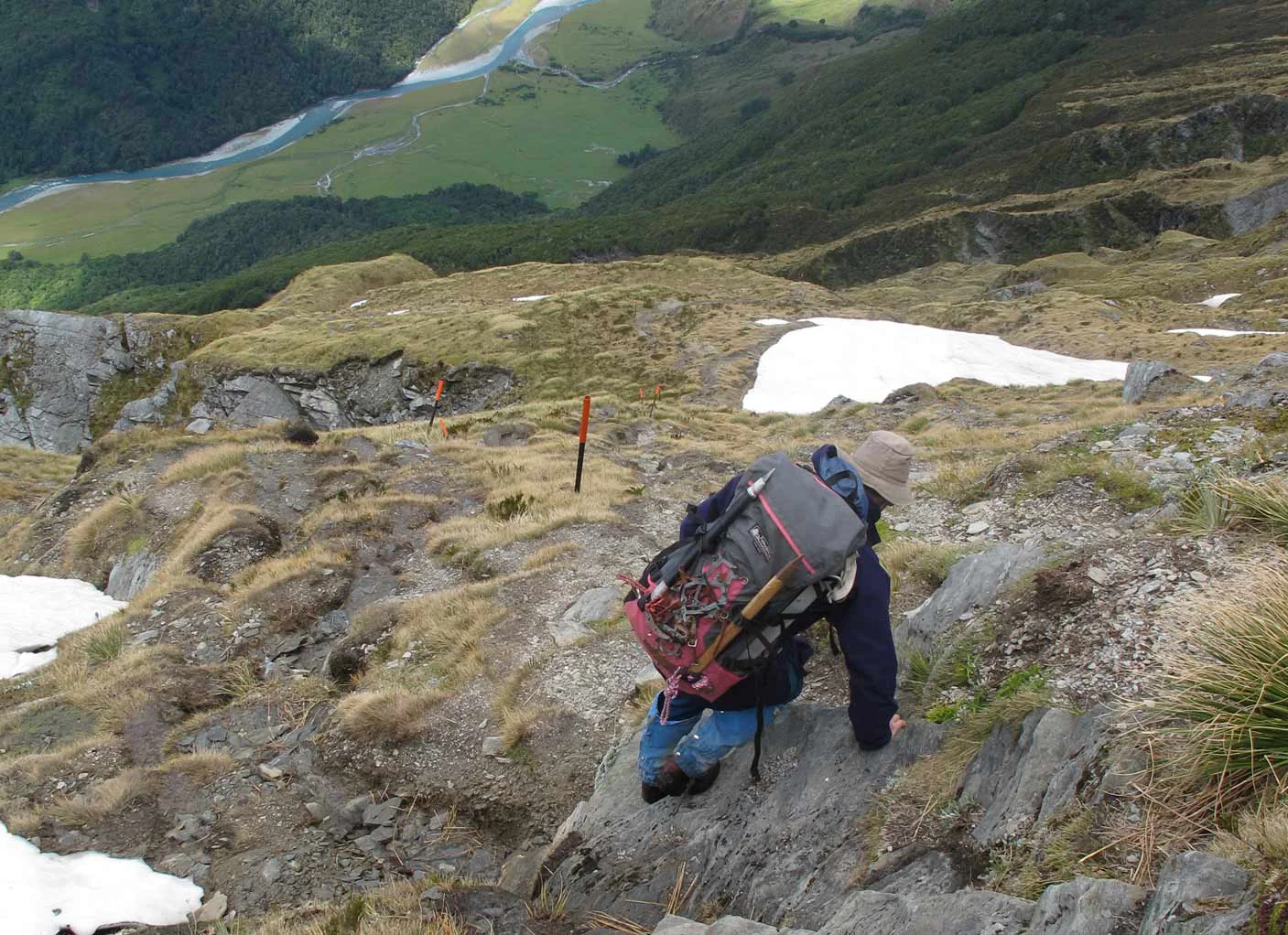
Beyond Aspiring Hut, the track climbs through mixed beech forest. Near the bushline, an unbridged stream can flood and become impassable in heavy rain. Above the trees, the track becomes a route marked by orange poles, and the terrain shifts to steep snow grass, tussock, rock outcrops and ledges. DOC
Treat the bushline as a decision point: weather, time and energy determine whether continuing is sensible. The exposed route is narrow and steep, with slippery rocks, steep drops and sections that require using your hands. Snow calls for an ice axe, crampons and the skills to use them; storms can bring snow even in summer. DOC
The pylon and Cascade Creek
A steep, narrow gully reaches the ridge pylon at 1835 m. Snow can linger there, and the final climb is especially hazardous in snow or strong winds. Pause at the top to reassess: Dart Hut is still 6 hours away, so poor conditions may make turning back the safer choice. DOC
From the pylon, orange poles lead down to Cascade Creek. Rain or snowmelt can make the creek unsafe to cross. The route then reaches easier slopes and flats toward Cascade Saddle at 1524 m. Camping is allowed only at the site near Cascade Creek, which has a toilet; kea there may chew tents or take gear. DOC
Across the Dart Valley
Just before Cascade Saddle, the route toward the Dart and Rees valleys turns left. Follow orange poles along the ridge, then cairns down steep, unstable slopes to the Dart Glacier valley floor and lateral moraines. This traverse is above 1500 metres and exposed to weather. Keep to the true left bank of the Dart River/Te Awa Whakatipu and ford several side streams, whose levels can rise with rain or afternoon snowmelt. A bridge near the Dart and Snowy Creek confluence leads to Dart Hut. DOC
The listed crossing takes 4–5 days one way, including the walk out via the Rees or Dart valleys on the Rees-Dart Track. Stream delays, low visibility and wet or windy conditions can change the plan; carry emergency shelter, spare food, a head torch and a distress beacon. DOC
Sources & further reading
Sources, dates, or details to query? Read our editorial approach.


