
A route shaped by conditions
Gertrude Saddle is a demanding alpine outing for fit, experienced trampers. The route is 7 km return via the same track and is graded expert, with a listed time of 4-6 hr. It begins at Gertrude Valley carpark, about 98 km along Milford Road from Te Anau. Wet weather, snow or ice can make conditions treacherous in any season. DOC says not to attempt the route in rain or snow, and does not recommend it in winter because of avalanche danger. DOC
The marked track initially meanders up the valley through alpine vegetation. At the head of the valley, the route turns toward the saddle and permanent track markers end. The change matters: beyond the bushline, navigation relies on alpine skills, a topographical map and judgment, with rock cairns placed by trampers marking the way. This is not a route where a visible, continuously marked trail can be expected. DOC
Stream crossing and steep slabs
About halfway up toward Black Lake, the route crosses Gertrude Stream below a large, steep waterfall area. Multiple rivers and side streams make water levels part of the day’s decision. After rain, creek crossings can mean wet feet; do not cross a flooded or unsafe stream, and turn back or wait if safe entry and exit points are unclear. DOC
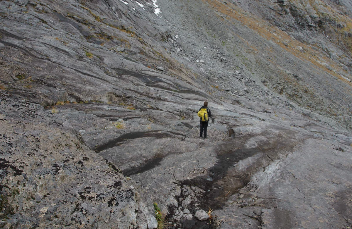
Above the stream, steep rock slabs and boulders change the outing from a valley walk into a serious scramble. Some sections are very steep and unsuitable for people with limited tramping experience or a dislike of heights. Steel cables assist on the slabs, but wet moss, frost and rain make the rock treacherous. The cables do not remove the need to judge each step and the conditions. DOC
The saddle and the return
From the head of the valley, the route continues through boulders to Gertrude Saddle. The reward is a view over the valley and part of Milford Sound/Piopiotahi. The same route is followed back, so the difficult stream crossings and steep surfaces must be negotiated in both directions. The route also provides access to the mountains for experienced climbers. DOC
The practical choice is whether the weather and the party’s experience, equipment and navigation skills suit an unmarked alpine route that day. The source advises carrying a personal locator beacon and checking the Fiordland forecast; after snow, avalanche danger may persist, and avalanches usually occur from May to November, with possible danger outside that period when snow remains. Dogs are not permitted; other pets are subject to conservation-land rules. DOC
Access and preparation
The approach is by road to Gertrude Valley carpark on Milford Road. Above the bushline, markers are not permanent, and the route crosses rivers and steep granite slabs; current weather and river conditions therefore shape whether the saddle is a reasonable objective. Carry the right equipment, including a personal locator beacon, and use a topographical map alongside the cairns. DOC
Sources & further reading
Sources, dates, or details to query? Read our editorial approach.


