
A demanding start
Kapakapanui is an isolated minor peak in the southwest corner of the Tararua Range, and its open summit is the draw of this loop. The route starts on private property at Ngatiawa Road, so park considerately and keep dogs on a lead. From Waikanae, follow Reikorangi Road and turn into Ngatiawa Road; from the Hutt Valley, use Akatarawa Road to reach the same turn. DOC
The first 20 minutes involve nine unbridged river crossings. Expect wet feet, and treat river conditions as a go-or-turn-back decision: do not cross if the river is in flood or its safety is uncertain. The crossings make recent rain consequential from the outset, before the steep tramping track has properly begun. DOC
Forest with a rough edge
Beyond the rivers, the route climbs through forest that still bears the marks of the devastating 1936 cyclonic storm. The track is rough and muddy, with many tree roots; in wet weather it becomes very slippery. This is a route requiring good fitness and balance, not simply a long walk to a viewpoint. DOC
DOC recommends choosing a different track in wet weather or after heavy rain. The combination of steep ground, slick roots and numerous crossings affects both footing and timing. Pack spare food, emergency equipment, navigation aids and a torch, leave early, and allow extra time in case progress is slower than expected. DOC
The open summit
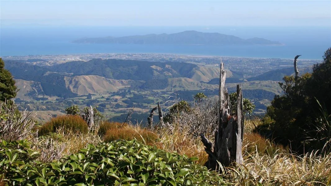
At the summit, the view takes in the full extent of the Southern Crossing and the forested uplands of Renata-Maymorn-Akatarawa. The outlook also reaches across the Kapiti coastline to Kapiti Island, 22 km to the west. The contrast between an open high point and the featureless forested maze around it gives the summit its particular character. DOC
Kapakapanui stands at 1102 metres, dominating the skyline from Paraparaumu and Waikanae. The summit is therefore more than a brief clearing in the forest: it is a prominent landmark with a broad regional outlook. The route is listed as a 7–9 hr loop from Ngatiawa Road via the summit, graded Advanced tramping track. DOC
Make the conditions part of the plan
The track’s surface and river crossings make weather the central planning choice. Check the forecast and avoid setting out in wet weather or after heavy rain; never continue across a flooded river or when safe crossing points are unclear. Dogs are allowed on a leash. The listed hut facilities include 6 bunk beds, heating, mattresses and non-flush toilets; tap water is untreated and should be boiled. DOC
The carpark is reached by following Ngatiawa Road for another 3 - 4 km after turning off Reikorangi Road from Waikanae, or after joining Ngatiawa Road at the Akatarawa Road junction from the Hutt Valley. Since the track begins on private property, considerate parking is part of access. Plan for a challenging day, not a casual summit stroll. DOC
Sources & further reading
Sources, dates, or details to query? Read our editorial approach.


