
A coast-to-coast sequence
The Te Paki Coastal Track follows the northern coastline from Kapowairua (Spirits Bay) to Te Paki Stream, passing Cape Reinga/Te Rerenga Wairua. The full route is 48 km total one way, listed as a 4-5 day advanced tramping track. Four campsites lie along it, and walkers can choose the whole route or individual sections. It is part of Te Araroa Trail. DOC
At the eastern end, Kapowairua to Pandora is 9km one way and 3 hr. Walkers can follow Spirits Bay beach to the orange dune marker, then cross the dunes to Waitahora Lagoon and its boardwalk, or take the firmer, easier track behind the sand dunes. Pandora is a place to observe shore birds or camp. After heavy rain or storms, the lagoon entrance can flood and submerge the boardwalk; if markers are not visible, there is no alternative route across. DOC
Ridge views and the Cape
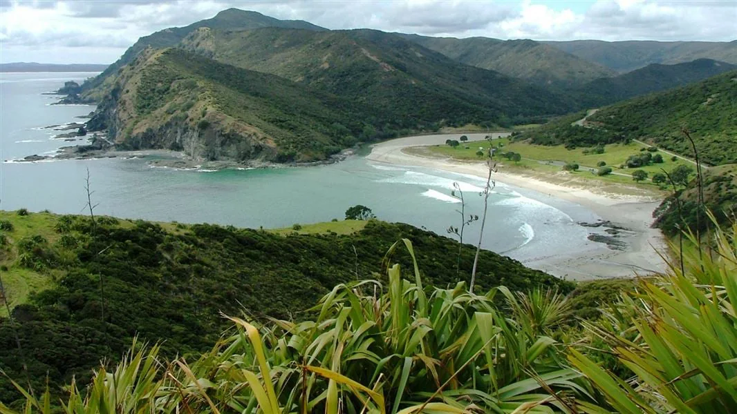
Pandora to Tapotupotu Bay is 9 km one way and 3 hr. The track climbs through vegetation to a junction, where the Pandora Track heads toward SH1; the coastal route continues along a ridge with views over Te Paki Reserves, both north and west coasts, sand dunes, Cape Maria Van Diemen and the distant Cape Reinga lighthouse. Fernbirds, grey warblers and pink and white manuka in spring mark this section before the path reaches coastal cliffs and descends to Tapotupotu Bay. There are steep ocean-side drop-offs. DOC
From Tapotupotu Bay, a steep climb opens views back east along the coast or toward Cape Reinga Lighthouse and Manawatāwhi/Three Kings Islands. The 5 km one-way section to Cape Reinga/Te Rerenga Wairua is listed as 3 hr, following cliffs before descending to Sandy Bay. The beach is a suitable place for a snack or lunch: the source notes it is not culturally appropriate to eat at Cape Reinga/Te Rerenga Wairua. DOC
From Te Werahi to the dunes
A separate 2 km return track descends west from the Cape Reinga/Te Rerenga Wairua Lighthouse Walk to Te Werahi Beach; the listed time is 45 min return. The route passes steep cliffs, with further drop-offs toward the ocean. Continuing west, the 7.25 km one-way stretch from Te Werahi Beach to Twilight Beach takes 3 hr through dune landscapes, with views of Cape Maria van Diemen and Motuopao Island. DOC
From Twilight Beach the track ascends above the beach through low-growing vegetation, with views across Te Paki Farm, then uses a board stairway to cross dunes to Te-Oneroa-a-Tōhē/Ninety Mile Beach. The 11 km one-way section to Te Paki Stream is listed as 4 hr 30 min. It follows the beach south to the popular vehicle entrance at Te Paki Stream, then turns inland along the stream through dunes to the parking area and toilets. Cars and tourist buses may use the beach entrance. DOC
Choosing sections and conditions
The route is not flat: well-formed track alternates with beach, and long climbs rise to undulating ridges. State Highway 1 reaches the northern area from Kaitaia; vehicle access is listed for Spirits Bay, Tapotupotu, Cape Reinga and Te Paki Stream, with gravel-road approaches at some starts. Check tides because waves can wash over sections in rough seas or at high tide. Streams can rise after sudden rain, and larger ones may be uncrossable; limited mobile reception means someone should know your plans. Beaches have rough seas and strong currents, while lagoons and estuaries beside campsites are the safer swimming options. Dogs and other domestic animals are prohibited, except certified disability assist dogs. DOC
Sources & further reading
Sources, dates, or details to query? Read our editorial approach.


