
The road to The Gums
The walk begins at The Gums parking area and shelter at the end of Makahu Road, 500 metres from the Mangatutu Hot Springs and camping area. Getting there is part of the outing: Makahu Road is 75 km north-west of Napier, reached via Puketitiri Road and Pakaututu Road, and the final approach includes about 1 hr on unsealed gravel roads. A ford on Makahu Road 7.5 km from the road end can be affected by heavy rain and snow melt. The road is steep and narrow in places, may be slippery when wet, and is unsuitable for caravans or campervans. DOC
From The Gums, the track follows the true right of the Mohaka River to Te Puia Hut. This first leg takes 2–3 hr and makes the hut a clear overnight destination for anyone who wants a shorter tramp before continuing farther upriver. The serviced hut has 24 bunk beds, heating, mattresses and non-flush toilets. Its tap water is untreated and must be boiled before use. DOC
From hut to river pools
Beyond Te Puia Hut, the track continues upriver, passes the Makino Hut turnoff and crosses a bridge over the Makino River just above its meeting with the Mohaka. It then follows the Mohaka through native bush and rolling terrain. Steep drop-offs in some sections open views toward the foothills, so this is a walk of changing footing and exposure rather than a flat riverside stroll. DOC
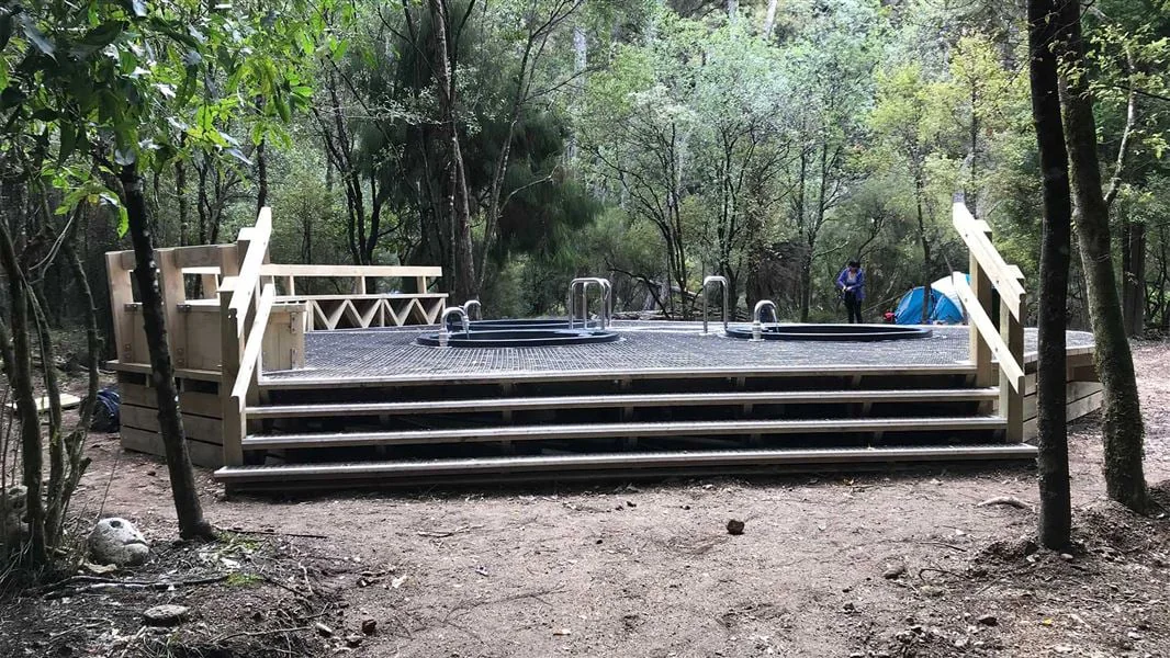
The final descent to Mangatainoka Hot Springs is steep. Three pools sit on a small manuka terrace beside the Mohaka, surrounded by decking; valves control their water flow and allow the tubs to be emptied. The adjacent Mangatainoka Hot Springs Campsite gives the pools a practical overnight context. The track from Te Puia Hut to the springs takes 45 min. Travel upriver beyond the springs enters private land and requires prior permission from the landowner. DOC
Plan the outing around access
The full trip is listed as 1–2 days on an intermediate tramping track. Drivers should account for the gravel approach and ford, whose water level can rise with rain or snow melt; 4WD vehicles are recommended for Kaweka Forest Park roads. Check for road closures before setting out. The source also notes that wasp populations may increase in warmer months, and advises light-coloured clothing and appropriate medication. DOC
This outing suits a choice between stopping at Te Puia Hut and continuing to the hot springs. The first option follows the Mohaka to a serviced hut; the longer one adds the Makino bridge crossing, bush and rolling ground, exposed drop-offs and a steep descent to the pools. Dogs are allowed only with a DOC permit for recreational hunting or management purposes; other pets are subject to conservation-land rules. DOC
What the route offers
The route links two distinct river settings: the Mohaka-side hut reached from Makahu Road and the small terrace where the hot springs sit beside the river. That makes the overnight option a natural way to extend the walk, while the hut’s facilities and the campsite beside the pools offer different places to pause. Boil the hut’s untreated tap water before drinking. DOC
Sources & further reading
Sources, dates, or details to query? Read our editorial approach.


