
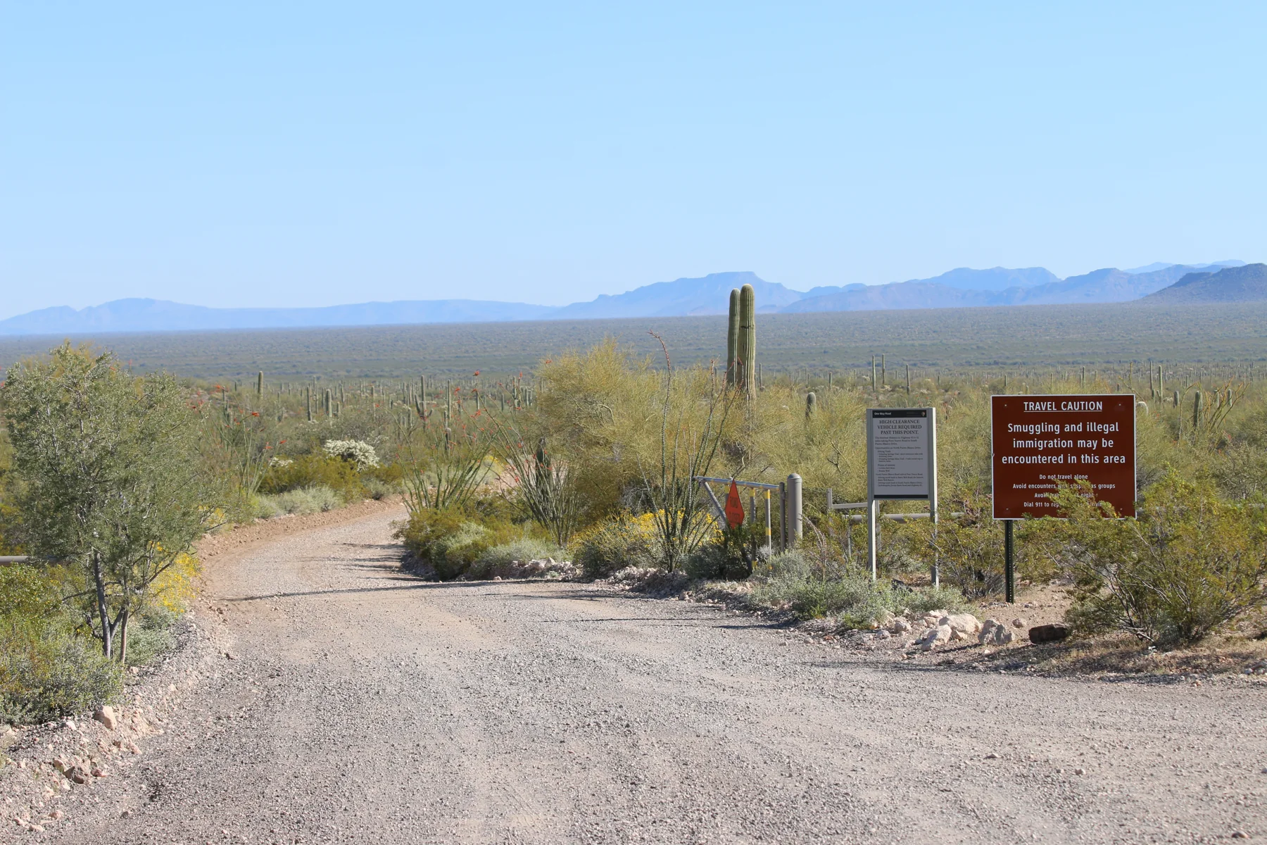
A road with a turning point
North Puerto Blanco Drive begins as a two-way road suitable for passenger cars. The first outing option ends at Pinkley Peak Picnic Area: mountains and dense saguaro concentrations line the way, and the picnic area looks toward Pinkley Peak and the Valley of the Ajo. Beyond this point, the road changes character and becomes a rocky, one-way route intended for high-clearance vehicles. NPS
That change sets the day’s main choice. Turn around at Pinkley Peak for the shorter drive, or continue knowing the onward choices are South Puerto Blanco Drive or the high-clearance, four-wheel-drive exit via Pozo Nuevo and Bates Well Road. The road beyond the picnic area can wash out after storms, so check conditions with a ranger before committing. Trailers, buses, and motorhomes over 25 feet (8 meters) are prohibited. NPS
From cinder and cactus to springs
The longer loop strings together a varied set of stops: Red Tanks trailhead, Dripping Springs, Golden Bell Mine, Bonita Well, Senita Basin, and Quitobaquito Springs. The route’s appeal is its combination of volcanic geology, mining history, and natural springs; the landmarks make the drive feel less like a single viewpoint run and more like a sequence through different parts of the monument. NPS
Picnic areas are available at Pinkley Peak, Golden Bell Mine, Bonita Well, and Senita Basin. Pit toilets are listed at Pinkley Peak Picnic Area and Bonita Well. There is no water anywhere along the drive, so supplies need to cover the whole outing; the park advises at least 1 gallon per person per day. NPS
Match the route to the vehicle
The North Puerto Blanco-to-Pinkley Peak option is 10 miles round-trip and takes 30–45 min round-trip. For drivers with high clearance, the entire loop from the North Puerto Blanco entrance back to Highway 85 is 41 miles and takes 4–5 hours round-trip. These are distinct choices, and the longer figure belongs to the complete loop rather than the northern road alone. NPS
There is also a different exit for high-clearance, four-wheel-drive vehicles: continue north toward Ajo via Pozo Nuevo and Bates Well Road. That route is 62 miles from the North Puerto Blanco entrance back to Highway 85, with the exit on Darby Wells Road by Ajo. Pozo Nuevo is sandy and can wash out after storms; its views include the Cipriano Hills, Growler Valley, and historic Pozo Nuevo line-camp. Bates Well Road passes the Bates Well Ranch site. NPS
Prepare for rough ground
Most trails and picnic areas along the drive are unpaved, uneven, and steep in places, and are not ADA accessible. Pinkley Peak Picnic Area is the exception identified by the park: it has an accessible picnic area and restroom. The contrast makes the passenger-car turnaround a practical option for visitors seeking a more accessible stop. NPS
Do not cross flooded washes, and expect the route beyond Pinkley Peak to be especially vulnerable to storm damage. Pets must remain leashed and cannot go on trails or into the backcountry; unattended pets are not allowed. Fires are prohibited on the drive. Those limits, plus the lack of water, make vehicle choice and preparation central to planning this remote outing. NPS
Sources & further reading
Sources, dates, or details to query? Read our editorial approach.


