
A remote network of short hikes
The Cathedral and Hartnet roads open access to a scatter of short hikes across Capitol Reef’s northern Cathedral District. Here the Waterpocket Fold gives way to broad desert, volcanic dikes, and freestanding sandstone forms. There is no single maintained trail linking the area: each outing starts from a different roadside point, and some paths fade into open ground. NPS
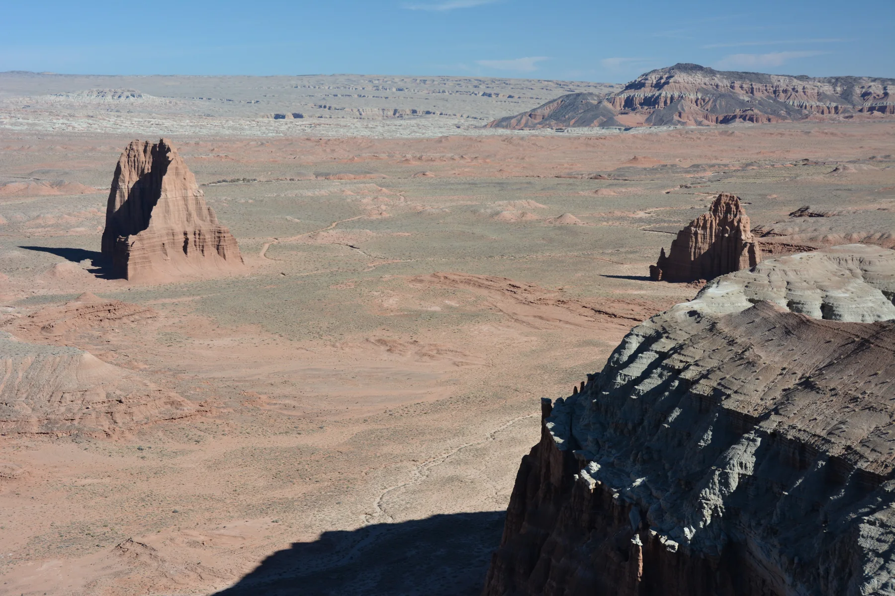
Choose by the kind of landscape you want to read. The Cathedrals Trail follows a low ridge parallel to the valley’s line of monoliths; the Upper Cathedral Valley Overlook gives a compact view down onto them. Farther south, the South Desert routes look toward cliffs, the Henry Mountains, and the volcanic formations around Jailhouse Rock and Temple Rock. NPS
Ridge, saddle, and desert views
On the Cathedrals Trail, a short steep ascent leads to a relatively level walk west along the ridge. A small hill at the end opens a broad view of the monoliths and Upper Cathedral Valley. The Upper Cathedral Valley Overlook is a gentler alternative: a short, rolling path reaches a panorama from above the valley. NPS
For a more involved viewpoint outing, the Lower Cathedral Valley Overlooks route crosses a brushy flat and climbs steeply to a saddle above the Temples of the Sun and Moon. A second saddle lies east, reached by returning to the cliff base and following a sandy wash. There is no reliable trail between the viewpoints, so the return crosses country rather than following a continuous path. NPS
Jailhouse Rock and the cabin
The Jailhouse Rock and Temple Rock route begins on an old road at Lower South Desert Overlook. It reaches a viewpoint above Jailhouse Rock, then continues on a switchbacking track that disappears across the valley floor. A faint track skirts the rock’s north side and crosses the South Desert before rejoining the road; beyond a low passage between volcanic dikes, a climb onto the left dike reveals Temple Rock, an eroded Entrada sandstone monolith. NPS
For a shorter stop with a historical landmark, follow the old road to Lesley Morrell’s cabin. Local cowboys used it as a seasonal camp from the 1930s until 1970; visitors can look through its windows, and remains of a small corral sit south of the cabin near a wash. NPS
Make the approach part of the decision
These routes are backcountry outings, not maintained trails. Surfaces include slickrock, packed dirt, stone steps, and loose gravel, and none are paved. The access roads require high-clearance vehicles; four-wheel drive is often recommended. Bentonite clay can turn impassable when wet, deep soft sand occurs, and the roads are infrequently maintained and not plowed in winter. At the south end of Hartnet Road, the Fremont River must be forded, with no bridge. NPS
Spring, summer, and fall are the listed seasons, but weather and road conditions govern access. Storms can cause flash floods, while rockfall and changing canyon obstacles affect routefinding. Check the Cathedral Valley forecast and road reports before departure, ask about the river ford, and carry map-reading skills, water, food, and clothing for changing conditions. NPS
Sources & further reading
Sources, dates, or details to query? Read our editorial approach.


