
Starting behind the pump house
West Prong Trail begins across from the entrance to the Great Smoky Mountains Institute at Tremont. From the parking area, find the pump house uphill to the left; the trail starts behind it. Accessible parking spaces are available, and surplus parking, including space for large vehicles, lies just beyond the main lot. Remember that a park parking tag is required. NPS
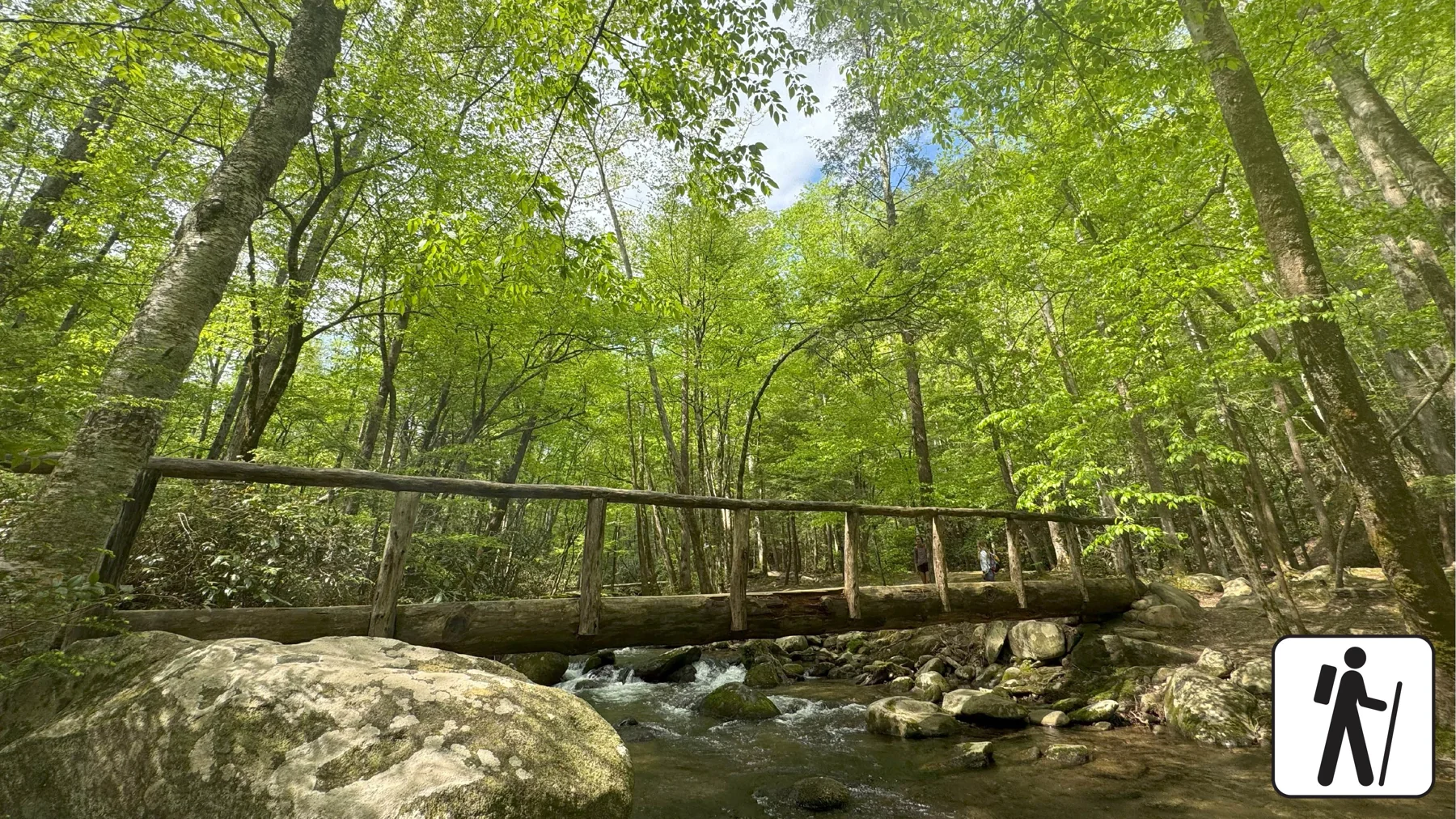
The trail climbs from Tremont Road toward Fodderstack Mountain and connects the Tremont area with Elkmont and Cades Cove trail systems. Its soil surface includes occasional rocks and roots, water crossings, log footbridges, and moderately steep grades. Seasonal wildflowers and wildlife, including deer, black bears, and invasive wild hogs, are noted along the route. NPS
A cemetery spur at the fork
At mile 0.3, a fork offers a 100-yard spur to Walker Valley Cemetery. The cemetery holds several residents of the area from the late 1800s and early 1900s, adding a settlement-history stop to a route otherwise defined by forest and river. West Prong Trail continues left at the fork. NPS
Hikers who take the cemetery spur can retrace their steps to the fork or follow an unmaintained trail that reconnects with West Prong Trail at mile 1.1. That choice matters for route-finding: the connecting path is unmaintained, while the clear return option is to walk back to the original junction. NPS
Forest, creek, and campsite
Beyond the fork, the trail scales Fodderstack Mountain through hardwood forest with pines, sourwoods, and chestnut trees. West Prong Little River runs below. At mile 2.0, a creek crossing is traversable by rock-hop, so footing and water conditions shape the small but specific decisions along the climb. NPS
At mile 2.1, the trail passes Campsite #18, a large group camping area beside the river with a fire ring and bear cables. The path continues through the campsite, across the foot log bridge to the right, then left at the hemlock tree. Reaching the sign for campsite A means the trail has been missed; turn back into the campsite to locate it. NPS
Bote Mountain junction and return
West Prong Trail ends at mile 2.7 at its junction with Bote Mountain Trail. The described hike returns along West Prong to the Tremont trailhead, making the full outing 5.4 miles roundtrip. The endpoint is a trail connection, not a loop, so hikers should account for retracing the route. NPS
Pets are not permitted on this trail; the park allows them only on the Gatlinburg Trail and Oconaluftee River Trail, as well as in picnic areas, campgrounds, and on roads. A restroom is listed at Smokemont Campground. The trail’s creek, footbridge, roots, and moderately steep grades make suitable attention to footing part of the outing. NPS
Sources & further reading
Sources, dates, or details to query? Read our editorial approach.


