The colour changes along Route 431
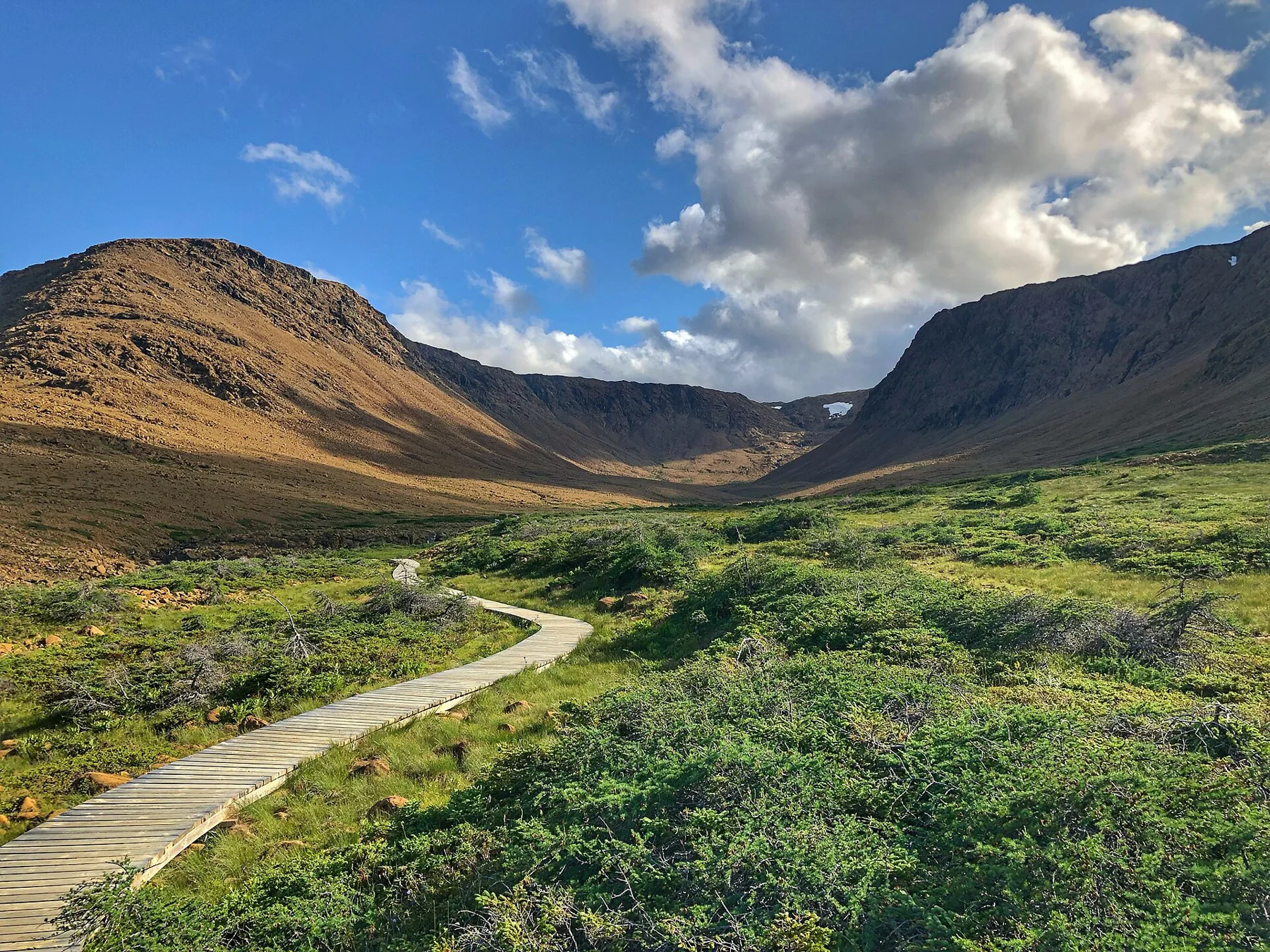
Between Woody Point and Trout River, Route 431 crosses a striking boundary between green mountains and the orange, sparsely vegetated Tablelands. The contrast introduces the geology before the walking begins. The trailhead lies about four kilometres west of the Discovery Centre near Woody Point. Route source Route source
The Tablelands are a rare opportunity to see mantle rock at the surface. Their story involves rock formation, ancient continental collision, uplift and long erosion. Describing them simply as a place “pushed up from underground” compresses several different geological events into one.
An easy path below a difficult mountain
The signed Tablelands Trail follows an old roadbed along the mountain’s base toward glacial Winter House Brook Canyon. Parks Canada gives four kilometres return, eighty-eight metres of climbing and a one-to-two-hour estimate. The shorter Serpentine Loop is a separate option. Route source Route source
The modest trail stays below the unmarked plateau. Reaching the mountain top is an off-trail undertaking requiring appropriate navigation, rather than the inevitable final climb of the easy path. The view from below is enough to understand the scale of the exposed rock.
An apparently empty landscape still holds life
Parks Canada draws attention to small plants surviving among the rocks. Sparse vegetation makes an impression of barrenness, but that impression should encourage closer observation rather than free wandering across every patch of ground. Stay on the path as much as possible. Route source
Winter House Brook Canyon adds a younger, glacially shaped landscape to the much older rock story. Looking from loose stone near the path to the larger canyon gives the walk more than one scale of time to consider. Route source
Use interpretation when it is actually running
The park offers seasonal guided interpretation, with summer walks beginning at this trailhead. Current departure information should come from a park facility; the existence of a summer programme does not promise an October tour. Route source
The lower route works well as a focused geological visit: arrive by the road that reveals the colour contrast, follow the old roadbed to the canyon, then return with a clearer sense of why these mountains differ from their neighbours.
Sources & further reading
Sources, dates, or details to query? Read our editorial approach.