Walk the circuit, not only to the photograph
The park’s S2 route begins at Skaftafellsstofa and forms a 5.8-kilometre circuit with about 250 metres of climbing. The official estimate is two hours. It links Svartifoss with the Sjónarsker viewpoint and Sel, giving the outing a geological and human-history sequence. Route source
Leaving the visitor center, the route passes the campground and the Eystragil footbridge, then Hundafoss and Magnúsarfoss before approaching Svartifoss. The best-known waterfall is therefore part of a succession of streams and slopes, not a single isolated stop.
Read the columns around the fall
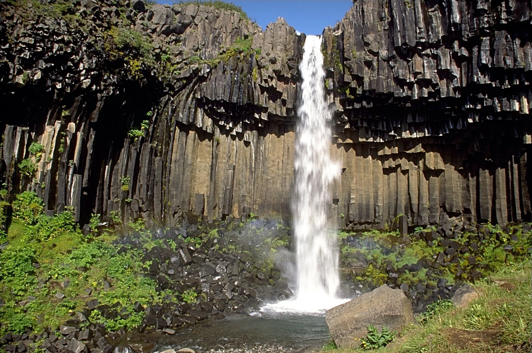
Svartifoss drops in front of basalt columns formed as lava cooled and contracted. The park’s geology account traces the lava to an old river channel around three hundred thousand years ago; the cracks formed in relation to the cooling surfaces. The dark geometric setting is the reason this modest waterfall has such a distinct identity. Route source
Look at the wall as a whole as well as the water. The column fractures formed as the lava cooled and contracted. A photograph framed only around the falling stream can miss the feature that makes the location unusual.
Use Sjónarsker for the S2 return
After crossing Stórilækur to the west, the route turns toward Sjónarsker and its viewpoint dial, then returns to the junction before continuing toward Sel. The Icelandic official S2 description gives this sequence. Sjónarnípa belongs to a different extension; the similar names should not be substituted for one another. Route source Route source
Adding an alternative viewpoint changes the outing. Keep the distance attached to the selected circuit rather than combining names from several Skaftafell walks into one apparently short route.
The turf farm completes the story
The old hay road leads down to Sel; from the farm the route heads east toward Bæjargil and returns through Lambhagi to the visitor center. The farm and historic route add a history of living beneath the mountains to the much older rock formations around the waterfall. Route source
The circuit includes timber, stone and metal steps. Wet surfaces can be slippery, and snow or ice changes the winter outing. A formed path through birch and grass should not be mistaken for proof that every part of the loop remains straightforward in every season. Route source
Sources & further reading
Sources, dates, or details to query? Read our editorial approach.