A collection of slipped landforms
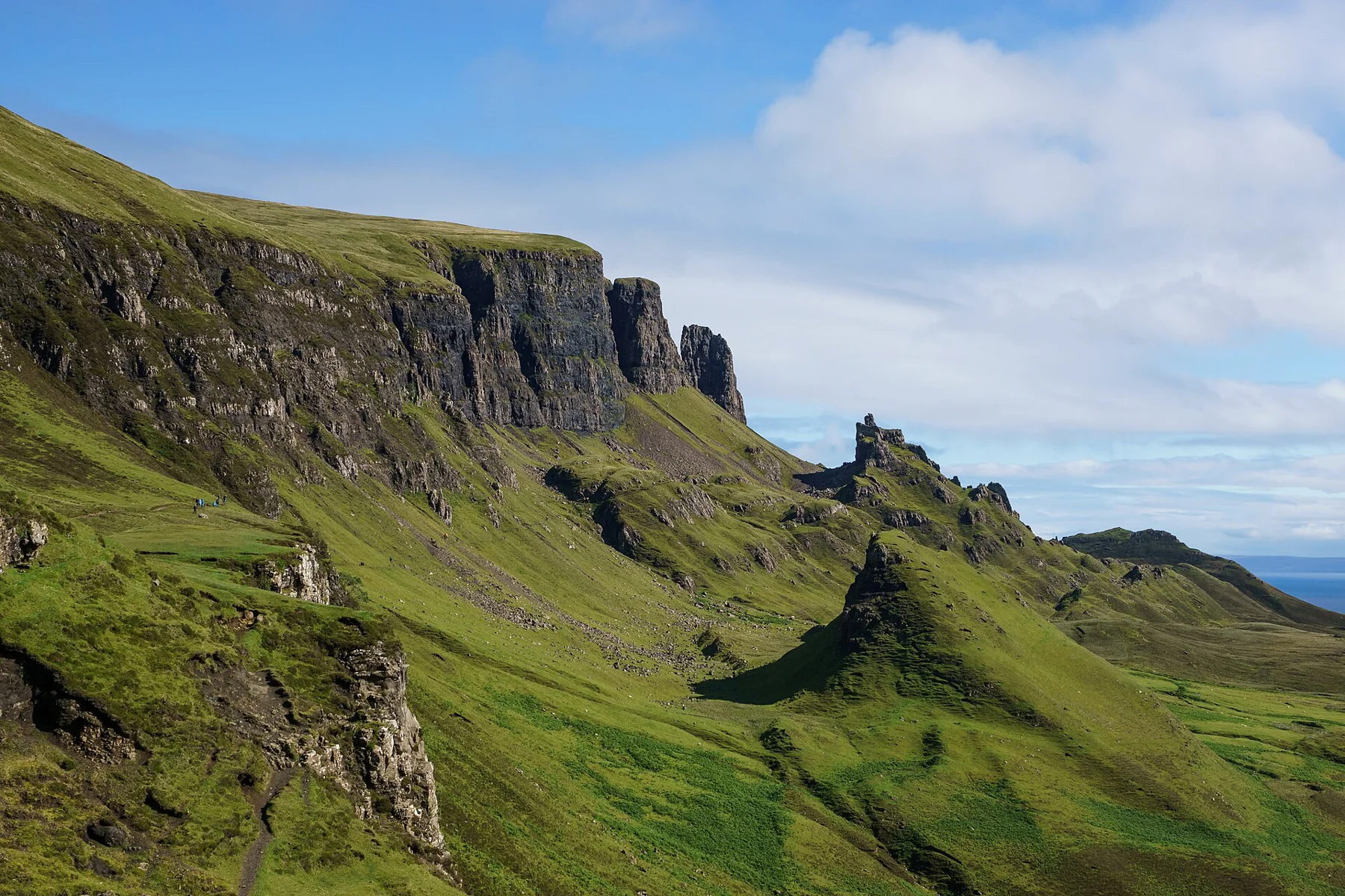
The Quiraing is a group of formations in Trotternish’s landslipped landscape. Detached blocks, small lochs, pinnacles and broken slopes give the ground an irregular structure that is easier to understand while moving through it than from a single roadside view. NatureScot identifies this east-facing escarpment as one of the area’s defining qualities. Route source
The Skye Ecomuseum lists a 6.5-kilometre outing taking roughly three to four hours. Several variations exist, so choose a mapped route before treating that distance as a promise for every path beneath or above the cliffs. Route source
Learn the names under the cliffs
The traditional path passes below the cliffs toward Am Prìosan, the Prison, and An t-Snàthad, the Needle. The local account describes the Needle as a 37-metre pinnacle. Am Bòird, the Table, is a concealed grassy feature rather than an obvious summit on the skyline. Route source
Those names help break a complicated landscape into recognisable parts. They are useful subjects for a walk, but they are not instructions to climb toward every feature. In particular, seeing a named formation on a map does not make a steep informal approach part of the chosen walking route.
Decide whether to go above the escarpment
A circuit over Meall na Suiramach changes the outing from a lower traverse into a route over the high ground. The views may widen, but the route-finding and weather exposure change too. Returning below the cliffs and completing an upper circuit should be evaluated as separate choices. Route source
The wider setting includes crofting settlements, basalt sea cliffs and views across the sea toward the mainland. These relationships matter to Trotternish’s character; the pinnacles are part of an inhabited peninsula, not isolated props for a photograph. Route source
An alternative beginning at Flodigarry
The Ecomuseum also describes an approach from Loch Langaig near Flodigarry. It can provide a different way into the formations, but a through-walk between that trailhead and the main car park needs its own transport. The standard distance and the alternative start should not be quietly combined into one supposed loop. Route source
Sources & further reading
Sources, dates, or details to query? Read our editorial approach.